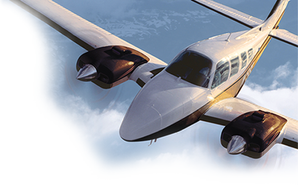


The Garmin Aera 660
by Michael J. “Mick” Kaufman
In a previous “Captain’s Corner” article entitled “The Pilot’s New Panel,” I covered the recent budget update on my Bonanza panel. I talked about the Garmin Aera 660, which was part of the installation, and I mentioned that it was the best piece of avionics that I have ever purchased in the $800 off-the-shelf price range. This article describes some of the features of that box — and why you should have one in your airplane.
By now, we have all figured out how important weather is to a pilot. The “Anywhere Map,” introduced a decade or more ago, became a necessity to pilots as the first usable inflight weather. In fact, pilots would not leave the vicinity of the airport without it.
Be aware that cell phone coverage becomes almost useless when flying more than a few thousand feet above the ground. In some areas you might occasionally be able to use a cell phone at a higher attitude. This is because the antennas on cell sites are optimized for a specific area. Therefore, they are tilted downward, as they are not meant for air traffic.
The Anywhere Map required being connected to a satellite phone with a subscription. So, there was a cost every time you checked weather in flight; however, it was worth it when flying long cross countries. I still have my satellite phone. I activated it recently for a short period of time for a flight into the Canadian wilderness on a fishing trip. I caught lots of fish!
A breakthrough in inflight weather came with the introduction of the Garmin 396, which used a subscription to Sirius XM for weather. This was fantastic. I still use that subscription service with the Garmin Aera 660.
We are now several years into ADS-B. With the government’s push to get pilots to spend money so they can spy on them, Uncle Sam first offered free weather in the cockpit as part of ADS-B. Some ingenious technician designed an ADS-B weather in a box that could be built on a $35.00 minicomputer. It was called the “Raspberry Pi.”
With the advent of inexpensive devices to provide free ADS-B weather, the incentive for pilots to spend thousands of dollars for ADS-B diminished, so the government offered monetary rebates for those who equipped their airplanes with ADS-B during a specified period. As of today, only 44% of U.S. aircraft are ADS-B out equipped – and ground-based ADS-B weather does not compare with satellite-based Sirius XM weather.
At the time of my panel upgrade, I needed to find a way to get displayed on my iPad using Foreflight. There were several devices on the market at the time, so I elected to try a device sold by Sporty’s Pilot Shop. I ordered one; it worked for a while and then quit working. I returned it to Sporty’s and got a replacement unit, which worked for a few days before it, too, died.
A new product surfaced from Garmin called the GDL-52. It was a bit pricier than the previous boxes, but I was able to work with Sporty’s (a great company to buy from) to get one. The GDL-52 arrived and worked flawlessly with Foreflight to provide Sirius XM satellite weather, ADS-B traffic in, AHARS and ADS-B weather all in one box.
I had made plans to have my old Garmin 396 reinstalled in the panel as my budget avionics install was already in progress. In a conversation with my good friend and BPT colleague, Randy Bailey, he suggested adding a Garmin Aera 660 to the panel to replace the Garmin 396. As luck would have it, there was an Airgizmos box the same size as the box holding the 396 in the panel. My installer was a little reluctant to make the change but agreed to do so. The Garmin 396, which was a gift from a dear friend, was not retired but installed in my seaplane.
In a word, the Aera 660 is awesome! The display is bright and crisp and puts the iPad to shame for readability in bright sunlight. After flying with the 660 for over two years, I have found that it does not overheat and shut down as the display on the iPad does. This has happened numerous times when I needed it most.
The Aera 660 is hardwired to the Garmin GDL-52 and my Garmin 480 and allows the transfer of data between these boxes. I can send flight plan data back and forth [except for the direct to command] going to the Garmin 480 from the 660. Using a Bluetooth connection with Foreflight, l can also exchange flight plan data with the 660.
My installer installed a toggle switch so I can select between each device. For example, when data is sent from the Garmin 480 to the 660, the switch is toggled, and the data is then sent to Foreflight on the iPad or reversed. This provides some of the same functions as Garmin’s FlightStream device, but with more features and less cost.
The Aera 660 resembles a Garmin 650 without the comm transmitter. Using some of Garmin’s Nav / Coms, the 660 can tune the transceiver from its database. The database on the 660 is updated from a Garmin subscription every 28 days and the price is very reasonable. The database includes VFR / IFR enroute charts, as well as all of the IFR approach charts and a base map. The update occurs when the unit is connected to WiFi, so there is no need for a computer or a cable. I snap the unit out of its Airgizmos adapter, take it home and turn it on and select “Update.”
The touch screen face of the Aera 660 is very similar to that of the Garmin 650, both of which have touch-screen icons. Beginning in the upper left corner is the base map, which displays cities, nav aids, airports and other items that are user selectable.
To the right of the base map is a charts icon, which allows the user to select VFR sectional charts, high and low altitude enroute charts and others. Next is a 3-D display that gives an AHARS display with 3 selectable configurations using the six-pack instruments, altitude, speed tapes and a configurable HSI indicator.
There is no AHARS in the 660 as it receives the AHARS data from the Garmin GDL-52, as well as GPS position data. The 660 does have its own GPS receiver, but I chose the one on the GDL-52, with a connected external antenna. The Aera 760 with the bigger display has its own internal AHARS.
To the right is the “Nearest” icon, which allows the pilot to find the nearest airports, flight service stations, nav aids, ATC center frequencies and others. The second row of icons features waypoints. It will display data received from a Garmin navigator, so in my airplane, it is the Garmin 480 or Foreflight on the iPad.
If an approach is loaded on the connected 480 navigator, the approach chart for that approach is automatically loaded and displayed on the Aera 660. The next two icons show “Saved” and “Active” flight plans with the ability to save 50 flight plans for future use.
The traffic icon not only displays ADS-B traffic, it allows the user to select different range, as well as information about displayed traffic by touching the icon. A voice provides traffic calls to alert the pilot of converging aircraft and terrain alerts, as well a 500-foot altitude call-out on an approach or while landing.
Other icons on the main page will show terrain and weather. On one of the setup pages, the user may select the “Source” for providing weather data from several options including Sirius XM, ADS-B or the Internet. The weather products available depend on the source providing the weather. Weather contains radar products, METARs, TAFs, winds aloft, cloud tops and much more. The option set in my airplane allows me to select different information on any screen I choose, for example, traffic on my Garmin 480, weather radar on Aera 660 and an approach chart with moving map on the iPad Foreflight.
The options and information available using the Aera 660 seem endless. Using it with the Garmin GDL-52 adds even more capabilities, including Sirius XM music and entertainment!
Please remember: as pilots, we need to fly the airplane! Too much information can cause problems.
Pick your favorite screen and don’t change anything once on the final approach segment. All eyes on the Primary Flight Director [PFD] when on that final approach segment. Don’t saturate that PFD screen if you have one with unnecessary information.
An HSI and a six pack of gauges is all you need, but a flight director is also a great device to have. Memorize only the information critical to the approach, like the Missed Approach Point [MAP] and the initial part of the missed approach segment. On a non-precision approach, the MDA is also an important item to memorize.
Enjoy the Garmin Aera 660 as I think it is the best avionics dollar you can spend.
‘Til the next issue of “Captain’s Corner,” Fly Safe!
Mick