

What I Learned About Mountain Flying by Not Flying in the Mountains
By Jim Gorman
2,500 Hour Instrument-Rated Commercial Pilot,
Single Engine Land and Sea, Private Glider
Any discussion about the wisdom of flying a small plane on a given day begins and ends with weather. I found an unexpected example of that when I took a mountain flying course in Denver this past August. I’ll start at the beginning.
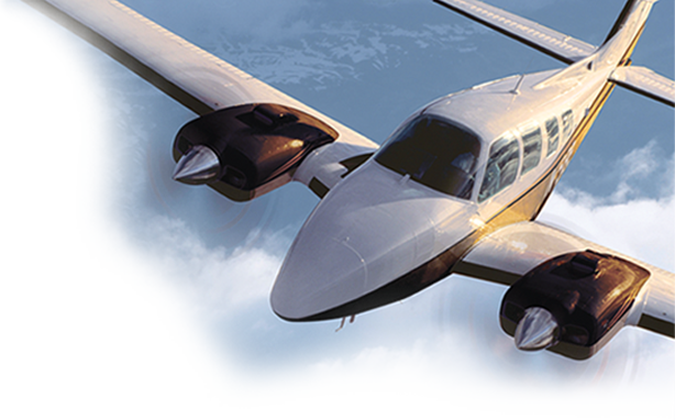
Like many flatland pilots, I’ve always longed to fly above more interesting terrain. Since the day I got my license, I’ve fantasized about a trip through the Rockies and on to the National Parks of Utah and Arizona. A couple of high-profile tragedies in the last few months provided graphic illustrations of the risks of blasting off through the high peaks without sufficient training and the awareness that mountain flying is a very specific skill. Both airplanes were almost identical to mine: highly capable Beechcraft Bonanzas with ATPs in the cockpit who had lots of experience but little or none of it in the mountains. One of the accidents was a V35 departing Telluride (KTEX) and the other, a G36, leaving Aspen (KASE). The Aspen accident was detailed in the November 2021 issue of AOPA Pilot Magazine. Since I have no desire to become a cautionary tale, I resolved to get some training before taking my airplane anywhere near the Rocky Mountains.

Since 1986, the Colorado Pilots Association (CPA) has conducted one of the most respected mountain-flying courses in the country. It was started by Vern Foster, who spent more than 70 years in the air. Foster learned to fly in 1939. During World War II, he trained Army Air Corps cadets and flew C-54s across the Pacific for the Air Transport Command. After the war, he became a captain for United Airlines, had chalked up 23,000 hours, and was still flying at age 92 when he wrote Flying in the Real World. Not coincidentally, Foster wrote the original textbook for the CPA Mountain Course and passed along his knowledge to the two men who continue to teach the program today. Bill Standerfer, Mountain Flying Chair, has been running the course for more than 30 years. His fellow CPA instructor, Bill Dunn, is an Air Traffic Controller who has been teaching it with Standerfer for more than twenty years. Between the two, they deliver scads of information with an easy demeanor and the authority that comes from decades of experience flying and teaching in the mountains.
The two-day class is generally offered twice a year, in June and August. Day one is a solid seven hours of intensive ground school. Day two takes pilots on a prescribed route with an experienced CPA instructor to landings at airports like Aspen with its famous one-way-out departure and Leadville (KLXV), the highest public-use airport in the country with a field elevation of 9,934 and a density altitude that often hovers above 12,000 feet. As the ground school got underway, Bill Standerfer was quick to remind the class that you don’t need a turbocharger to safely fly in the mountains, just knowledge. He talked about students who routinely learned to fly at Leadville in Cessna 172s.
Bill Dunn pointed out that GPS navigators and apps like Foreflight can only do so much for a mountain pilot. There is no straight-line, point-to-point flying in the Rockies. It’s largely dead reckoning and pilotage. An old-school paper sectional is necessary to get the big picture of all the challenges you’ll encounter and the decisions you’ll need to make between takeoff and landing.
Needless to say, a thorough weather briefing and a good flight plan are important no matter where you fly. Here in the Midwest, a flight plan generally means being aware of Minimum Enroute Altitudes (MEAs), restricted areas, adequate fuel stops, weather alternates, and so forth. I was struck by how much more homework is needed before planning a flight in the mountains. For example, you need to know that you don’t fly over the peaks in a light aircraft, many of which top 14,000 feet, but through the passes between peaks. And it’s not enough to know how to find the passes on a chart. You need to know the nature of each pass before you’re in it. Is it relatively low and flat with decent chances of a successful emergency landing? Or a high “complicated” pass with steep gradients that could lead you into a box canyon? For that matter, if a canyon diverges into two as they often do, which option are you going to take? The time to figure out any of that stuff is not while juggling a chart on your lap at 120+ miles an hour, but while you’re sitting at home or in the FBO.
Then there’s the weather. Where I live near the Great Lakes, our main concerns are thunderstorms, high winds, and icing, depending on the time of year. They’re concerned about those phenomena in the mountains, too, of course. But the wind can play havoc in far more ways than in the flatlands. Valleys and canyons can create a venturi effect like Giovanni Venturi never imagined. Mountain waves and their rotor cloud sidekicks cause turbulence that can top a mountain peak by several hundred feet and severe downdrafts that no GA aircraft can contend with.
Indeed, the lion’s share of the CPA ground school centered on weather and how to know what it’s going to do or, at least, how to not be surprised by it. To that end, the Colorado Department of Transportation (CDOT) and the FAA have established a network of AWOS stations far removed from airports, at key passes throughout the state. One of the things they’ve done is to position weather cameras that provide a real-time view in all directions at more than 23 passes, with another 20 to be added over the next few months. There’s even a side-by-side comparison of what an ideal weather day should look like so you can judge visibility and conditions before you leave for the airport. The weather cameras can be seen at https://weathercams.faa.gov. When you visit coloradopilots.org, there’s a link to the CDOT Division of Aeronautics website from which you can download a list of the AWOS sites and a Colorado Airport Directory, a very useful tool for any pilot visiting Colorado. Select the Mountain Flying Tab, scroll to “CO Mountain AWOS” and find the specific pass you’re interested in viewing. For that matter, coloradopilots.org is chock full of information about flying in the mountains. It is a must-visit site for anyone entertaining the experience.
And this brings me to that encounter with unusual mountain weather I was talking about. The CPA has a standing rule about visibility minimums of 10 miles. That’s rarely an issue since average flight visibility in Colorado frequently exceeds 50 miles. But these are not average times. California wildfires have impaired air quality all over the west, even affecting us here around the Great Lakes and further east. An email from Bill Standerfer alerted us before the course warning that the smoke could stand in the way of our flying and suggested we could either take the chance or cancel and reschedule for another time. I decided to chance it.
A couple days before the class was scheduled, the air quality had improved. But a shift in the wind and some new flare-ups brought new concerns about smoke. Some passes reported visibility as low as three to five miles, far below CPA minimums. By “go time”, the smoke was still lingering across much of the route we were set to fly. Needless to say, I spent day two on the ground. Was I disappointed that I’d flown 1,000 miles only to sit inside a classroom all day then go home? Nah.
That’s not true. Of course, I was disappointed. But, as I said, it all begins and ends with weather and I knew that long before I left for Denver. I respect weather minimums and had no desire to push them even if the instructors had allowed it. Besides, Standerfer and Dunn invited us all to come back and take the class again for free at the next class before the traditional start of fire season.
The more I thought about it, the more I realized that the ground school was so jam-packed with information that I would have been overwhelmed had I flown on day two, even though Bill Dunn said he does his best to distill the information to a manageable level when he has a student in the left seat. I’m sure I would have enjoyed the experience but not so sure how much I would have gained from it.
So, I’ll be back. In the meantime, I’ll review my notes before I leave home and be ready to hit the ground school running. I’ll also be doing a lot of hangar flying, daydreaming about my first flight through the Rockies.
One final note: This course will fulfill the requirements of the FAA’s “WINGS” program. See full details here.
Jim Gorman is an instrument-rated commercial pilot with glider and seaplane ratings and more than 2,500 hours in the air. He flies a Beechcraft F33-A Bonanza and is the owner of Gorman360, Inc., an advertising agency. When not busy making sure his plane is in tip-top shape, he volunteers for Pilots N Paws and other humanitarian organizations.